Thursday, February 23, 2012

Bonus(?) day off

I called into the post office today, and while the parts to attach my mudguards (sent separately) had arrived, the mudguards themselves hadn't. Also, the replacement gear lever for my bike didn't arrive until the afternoon, so the bike shop couldn't install it today.

As a result, it seems I've got no other option than to take an extra day off in Nelson - so I'll be here tomorrow, too, rather than on the road back to Blenheim. I'd honestly rather be back on the move again, but at least my bonus day off is in a nice town.

Today I went on a wine tour with a bunch of other people, the youngest of whom was at least 10 years my senior. I had fun, though, and liked a couple of wines enough to buy some and have them shipped to me.

Day 20: St Arnaud to Nelson

Distance: 94.3k
Distance so far: 1,254.9
k
Speed: 21.3k/h
Runkeeper log: 1


Note: This post refers to the 23rd of February, even though I'm posting it on the 24th. Today is a rest day.


If the hills made yesterday miserable, they made up for it today, with interest. Today's route from St Arnaud to Nelson was largely downhill, with only 3 significant climbs. Most of the downhill was similar in nature to the uphill I experienced yesterday, an incredibly gentle slope that, on the uphill side makes everything a bit more of a drag, but on the downhill side makes riding awesome. Instead of puttering along at 18k/h up a slope so shallow I can't see it, I spent the day cruising along at 25-30k/h, putting in practically no effort as I did so - as my average speed for the day demonstrates.


I started later than usual, since breakfast at the Alpine Lodge starts at 8, and the forecast was for rain to clear in the afternoon, which I wanted to give it plenty of time to do. It was still spitting a bit when I left, but stayed mostly clear as I made the first climb, back to the turnoff to Nelson. Once I was there, the glorious downhill started, and I was able to roar down that section in no time. Pretty soon I had to stop and take off one of my tops, since the day was milder than expected, and the rain absent entirely.


The second major hill hit just as the rain did, so after another stop to change clothes - this time to put on the raincoat - I conquered that climb too. Descending a fairly steep hill afterwards, with rain stinging every exposed bit of skin, was nevertheless still quite fun.


The third climb was much more gradual and sustained, starting with a weird section where the road appears to slope downhill, but actually climbs noticeably. This sort of illusion was somewhat of a theme for the day - often sections that appeared to be uphill were actually flat or even marginally downhill, and sections that appeared to be flat were noticeably downhill. It's weird to gear down for something and then discover you're not actually losing any momentum.


Finally, with all three main climbs out of the way, the rest of the day was glorious downhill, or flat, the whole way. While yesterday's ride seemed like an endless chore, today's was a breeze.


The last 12k or so into Nelson is largely along cycle trails - quite nice, and usually (though not always) well signposted ones. A word of advice for anyone following in my tracks: The "coastal route" is flat as a board, but the "old railway route", somewhat counterintuitively, should be called the "OMG hills!" route.


My mudguards finally arrived in Auckland, so I've directed them to be forwarded to me here in Nelson; I'm also expecting the phone charger I foolishly left in Wellington, and the replacement gear shifter I asked a bike shop to order in. As of today, though, none of those have arrived. Hopefully they arrive tomorrow, because I'm not sure what to do if they haven't.

Tuesday, February 21, 2012

Day 19: Renwick to St Arnaud

Distance: 92.2k
Distance so far: 1,160.6
k
Speed: 16.4k/h
Runkeeper log: 1

As you might guess from the nature of today's log, I opted not to spend the extra day in Renwick and tour the vineyards; there'll be time for that when I come back through this area after visiting Nelson.

A new record for distance for me today as I cycled just over 90 kilometers. In doing so, I gained about 700 meters of elevation, but the gain was extremely gradual - all but 200 meters of that was spread more or less evenly over the entire journey, making for a very gentle gradient indeed, though it was noticeable in the lower gear and lower speed I had to keep to for the day.

The forecast for today was rain in the afternoon, so I set out nice and early, getting on the road at about 7. There's practically nothing on the road, either, so I made myself breakfast before leaving, and took some lunch with me.

Defying the forecast, it started drizzling lightly almost immediately, and it kept drizzling on and off for the first half of the journey, adding a touch of misery to an already fairly dull journey. A little after the halfway mark, the drizzle devolved into outright rain, and I spent the second half of the trip dripping wet.

The road started to climb substantially about 10k from the end - though since my phone had died some time earlier, I didn't know exactly how far from the end I was - and levelled off after about 3k. The last couple of km were blessedly downhill, bringing me into St Arnaud at about 1:30.

I'm staying at the Alpine Lodge, who have a backpackers' in addition to their standard accommodation. The "Backpackers' Chalet" is reasonable, but a bit steep for what you get. At $69 for a private room it's more than the other places I've stayed at, and they nickel and dime you on top of that. Sheets are supplied, but you have to make your own bed, it's $2 for a towel, and they give you a token for the shower, with extra showers costing $2. I did manage to convince the friendly receptionist that since I was paying for a room that sleeps 2, I should get 2 shower tokens, however.

Tomorrow I'm headed for Nelson, an 89 kilometer ride, almost as long as today's. In its favor, though, are two things: It's mostly downhill, in a similar manner to today's gradual climb; and I have the much more bustling and interesting Nelson, and a rest day, to look forward to at the end of it.

On the down side, the forecast is now for rain tomorrow morning as well. I was already planning a later-than-usual start tomorrow so I can get breakfast here; it looks like I may have to procrastinate a little further to avoid the worst of the rain before I set out.

Monday, February 20, 2012

Day 18: Picton to Renwick

Distance: 45.1k
Distance so far: 1,068.4
k
Speed: 19.2k/h
Runkeeper logs: 1 2

Time to get started on the South Island! Today I caught the ferry from Wellington to Picton, then set out from Picton for my destination for the night, Renwick. Renwick is right in the heart of Marlborough's wine country, surrounded on all sides by wineries.

I was first off the ferry at Picton, with myself and the other bike riders positioned right at the front of the hold. Watching the enormous steel doors gradually lower was rather impressive.

The ride out from Picton was a real joy, except from the traffic. There's a short hill to get out of Picton, and then it's more or less flat the whole way, though it felt distinctly like a slight downhill. I cruised along between 25km/h and 30km/h, putting in next to no effort and enjoying the day and the scenery. Traffic was initially pretty heavy, but there was a shoulder most of the way, and the traffic lightened as the ferry emptied out.

Because if you don't you're going to have some mansplaining to do!
I stopped just outside Blenheim at Annie's, where I had a tasty toasted sandwich and a coffee, and picked up a couple of delicious fruit leathers, then continued on through Blenheim, where I made the turnoff to Renwick.

This area is truly saturated with wineries; there's often fields full of grapevines on both sides of the road, and there's plenty of places to go for wine tastings. I stopped off at a couple - Cloudy Bay and Fromm - and the wines were interesting, but none were so amazing I felt compelled to order some to send back home.

The next leg of the trip is west along the inland route to St Arnaud, but I'm considering staying an extra day here and doing a tour of the wineries. Another consideration is that my phone is on its last legs - it refuses to charge from anything except the official AC adapter, and is convinced it's charging even when it's not - and I foolishly left the charger in Wellington. Not having a phone is really going to put a dent in things since I'm using it both to track my progress and as my primary means of Internet access, so taking a day off would allow me to visit Blenheim and pick up a cheap Android alternate phone. I'm incredibly frustrated I have to do this, but getting angry at the phone doesn't seem to make any difference.

Sunday, February 19, 2012

Day 17: Wellington

Distance: 45.5k
Distance so far: 1,023.3
k
Speed: 15.5k/h
Runkeeper log: 1

As you might guess from the title and timing of today's post, I ended up taking the bus from Wanganui to Wellington, following the advice of several people who told me cycling parts of the road to Wellington was taking my life into my hands. Surveying the road from the bus along the way, I'm not inclined to disagree.

I'm a bit disappointed at having to compromise on my 'end to end' goal once again, but on the bright side it's gained me two days that I can spend doing more interesting and exciting things, like exploring the Nelson and Marlborough area.

Today I went out for a ride around Wellington's shoreline - and it has quite a bit of it. The Lonely Planet cycling guide has quite a nice suggestion for a loop, and I largely followed that. The shoreline segment was about 30km long, almost entirely flat, and passing along some lovely coastal scenery along the way. Even so close to town, traffic on most of the roads was very light, making it an all around pleasant ride and a nice way to spend the day in Wellington.

Once I'd completed the shoreline segment, there was a long but gradual climb up Happy Valley Road - nearly 5k long - followed by a much faster, windier descent back into central Wellington. This was mostly pleasant, except when an inattentive motorist cut me off and nearly ran me over in his rush to get onto the motorway onramp. I swore loudly, which attracted a bit of attention, from everyone except the motorist himself.

The ride back to the place where I'm staying was a bit of a slog, ascending Ngaio Gorge Road and then Cockayne Road, both of which are much steeper than Happy Valley Road - in some places so steep that my lowest gear started to feel a bit insufficient.

With that, the North Island part of my tour is done; tomorrow or the next day (I haven't decided for certain yet) I'll get on the Interislander and catch the ferry to Picton, and start my South Island trip. Tonight will be spent planning out exactly where I'm going and where I'll stay along the way.

In a way, as much as I've enjoyed the North Island, it's felt like something I was doing simply in order to be able to get to the South Island. Most people claim that the South Island is a better and more enjoyable place to ride for the most part, and I'm inclined to agree with them. I'm really looking forward to getting started on it.

Also, a major milestone: I've now cycled over 1000 kilometers in my NZ tour! Woohoo!

Friday, February 17, 2012

Day 16: The Flying Fox to Wanganui

Distance: 43.8k
Distance so far: 
977.8k
Speed: 14.9k/h
Runkeeper log: 1

Supposedly, when you've exerted yourself, you don't really feel the impact in your muscles until two days afterwards, and that certainly seemed to be the case today, as my legs made me pay for the epic day from Turangi to Raetihi, making me glad that today was only a short one.

John, my host at The Flying Fox, made me a delicious and generously proportioned continental breakfast, with muesli, fresh Orange Juice, yoghurt, strawberries, fresh bread and more. I had to declare defeat after eating about two thirds of it, lest I be unable to get on the trike. A quick cableway journey had me back on the far bank and ready to go.

Getting up the driveway was the first challenge, since it's gravel and grass and at least a 20% slope. Riding up it was no good, as the rear wheel couldn't get enough traction, so I spent the first 10 minutes or so of my day pushing my bike up the hill.

Once I was on the road, though, the ride was lovely. For some reason I found myself thinking that if hobbits discovered concrete, this is the sort of road they'd build. It's a fairly narrow, unmarked country road, with no markings or signposts, winding its way along the ravine, gently undulating up and down with the countryside. In places, there's no sign of human agency other than the road itself; in other places it's paralleled by farm fences and tall trees shading the road.

The one significant climb of the day came at roughly the halfway mark, and was fairly steep, but an even pace soon had me at the top, despite my legs vociferously reminding me that they were sore from the last couple days' riding. An entire tour bus of people stopped at the top for the view waved at me as I embarked on the downhill side. The downhill ride was a little terrifying, in the vein of yesterday's downhill towards Pipiriki, with steep slopes, sharp unmarked bends, and the constant fear of an oncoming car; I probably spent about half my hard won potential energy heating up the brakepads, but made it to the bottom in one piece.

The remainder of the ride into Wanganui was a bit dull, but very flat, a pleasant change from hills and a good way to rest tired legs. I checked in at the charming Tamara Backpackers. A brief walk into town had me there in time to browse the weekend market, where I met Annette, John's wife, co-owner of the Flying Fox, and mayor of Wanganui. How she finds time to run a market stall on top of all that baffles me.

My hosts here at Tamara have presented me with a bit of a dilemma for tomorrow. The route from here to Wellington, they report, is both boring and dangerous - a reminder of the segment just north of Auckland - and they recommended in the strongest terms that I skip the ride and catch a bus instead, making the observation that doing so is a common choice for touring cyclists. They pointedly mentioned several memorials to unfortunate cyclists along State Highway 1.

Once again I find myself somewhat conflicted as to what to do. Wanganui to Wellington is 200 kilometers, a fair chunk of the north island, and I'd planned to do it over 3 days: Wanganui to Palmerston North, Palmerston North to Waikanae, and Waikanae to Wellington. Skipping it feels distinctly like cheating, even more so than the shorter segment I opted out of north of Auckland. On the other hand, getting killed by a reckless motorist on State Highway 1 is likely to put a rather significant crimp in my plans, and it doesn't seem like I'll be missing out on much in the way of scenery or attractions.

If I must get a bus, it'd be nice to bike at least some of the distance, but the area immediately north of Wellington is reportedly the most dangerous bit, while the area from here to Palmerston North is distinctly boring (though flat - and I love flat).

Whatever I decide, I'll need to make my mind up soon. Wanganui is a nice little town, but I don't really want to spend more than one night in it, with the rest of the country beckoning.

Thursday, February 16, 2012

Day 15: Raetihi to The Flying Fox

Distance: 57.7k
Distance so far: 934.0k
Speed: 13.5k/h

Runkeeper logs: 1 2

Today saw me riding about half the way from Raetihi to Wanganui, stopping for the night at a rather interesting place called The Flying Fox. In sharp contrast to yesterday, the ride was more downhill than up, though there were some surprisingly tough uphill sections.

The Lonely Planet guide claims that 40k of this ride is on a gravel road, which I wasn't really looking forward to. I was very pleased to learn from a local in Raetihi, however, that most of the road has now been sealed, with only a 12k section remaining of the original gravel. Definitely good news to start my day with.

Riding out of Raetihi, the downhill started immediately, allowing me to enjoy the scenery as the road took me in broad sweeps through the countryside. While yesterday was about wide open vistas and views for miles, today's theme seemed to be more close in, with nearby bush-covered hills featuring most of the day. The downhils were welcome, but the uphills were surprisingly tough, requiring me to gear right down and grind up them at a snail's pace - though I suspect this was more to do with my legs being tired from yesterday's ride than it was due to the steepness of the slope. The road was very quiet - throughout the whole day I probably got passed in either direction maybe once every 20 minutes.

Near the halfway point was the tiny village of Pipiriki, where I stopped for a drink. A group of kayakers were very interested in my bike, and after talking to me, took turns riding it around the parking lot before setting out on their own adventure.

Leaving Pipiriki, I turned to follow the Whanganui river. Not much further on, I encountered the start of the gravel road - rutted, potholed, strewn with large stones, and entirely unpleasant to ride on, it spent more time going uphill than down. My progress, swift up until now, ground to a virtual halt even on the flat and downhill sections. Riding on the gravel road required constant attention to dodge the potholes and ruts, trying to find a bit of the road that won't jar myself or my bike to pieces in the process. I did get the occasional marvelous view of the river and the ravine it's gradually channeled out for itself, however.


After that long on a gravel road, riding on a sealed one is an almost religious experience. Making it to the end, I almost wanted to stop there and build a shrine to the Great And Mighty Roadbuilders, Hallowed Be Thy Names.

Has your car gone missing lately? Or maybe just your license plate?
After that, the remaining distance to the Flying Fox went fairly swiftly, impeded only by the hills, and I arrived - later than I expected, but still earlier than the arranged time - at The Flying Fox.

The Flying Fox is a pretty unique sort of place. It's on the other side of the river to the road, and access - as the name implies - is via a cableway suspended over the river.
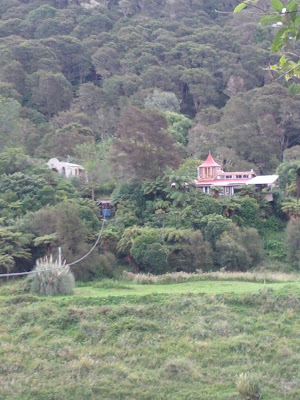
When the zombie apocalypse arrives, this'd be a pretty good place to be.
The cableway itself is clearly a DIY job, albeit a pretty impressive one - I wish I'd taken photos. The cable that supports the car is securely anchored at each bank, and power is provided by a secondary wire made of - I kid you not - number eight fencing wire. The wire runs around pulleys made from old car wheels at either end, and terminates on opposite sides of the car, which is made primarily from bolted together sections of alumnium L-section.

Power is provided by a motor driving one of the pulleys on the house side. You don't want to be the last person to leave the house, here - if there's nobody on the house end to activate the motor, you have to use a hand crank and winch yourself across the river by arm power. Crossing was an interesting experience, though it didn't feel at all like an unsafe one. The car's fairly slow, giving one plenty of time to admire the view.

My room for the night is the charmingly named "Glory Cart", an old wooden trailer caravan - gypsy style - that's been converted into a stand-alone sleepout. A gas-powered shower and a composting toilet I hope I don't have to use complete the ensemble.

Tomorrow I'll be continuing the rest of the way to Wanganui, a distance of only 46k. The terrain looks macro-scale flat, with only one very steep hill of more than 20 meters or so, but Earth shows it as very up-and-down and claims a total climb of over 900 meters. We'll see how true that is when I tackle it tomorrow morning.