Friday, March 9, 2012

To be continued

I'm sure this doesn't come as a total surprise, given the nature of my recent updates, but it's still a bit disappointing - I'm putting the rest of my tour on hold.

The weather lately has been awful, with more to come, and I've had a series of really bad leg cramps, though fortunately those seem to have mostly subsided now. I could still complete my planned South Island route if I left tomorrow, but it leaves me with very little wiggle room for unexpected trouble or further really bad weather - any further problems and I have to start cutting bits off my trip.

This is a to-be-continued, though - I fully intend to pick up my tour again when I get an opportunity; hopefully next summer.

If you've donated for a postcard and I haven't sent you one yet, let me know what you'd like me to do. I'll happily send you one from Christchurch, or if you'd prefer I can send you your money back from my own pocket.

On a more positive note, I've had a fantastic time doing the tour, all up. I've never done anything like this before, and it's been a great experience, and something totally different from anything I've done in the past. I'm hoping it leads to more (though probably shorter) tours like this in the future.

My apologies for letting people down by truncating the tour like this, and thank you for all your kind words and support.

Monday, March 5, 2012

More cramps

I tried a day ride today, out to Little River and back (about 50k each way). About 12k in, I got another cramp in my right leg and had to turn back.

Today was a rare fine day, too - the forecast is not good, though. Eleven of the next fourteen days have rain or showers forecast. I don't mind the occasional shower, but a tour that involves more rainy days than fine one is seeming less than pleasant.

I've not yet decided what to do, but none of the options are appealing at this point.

Sunday, March 4, 2012

Complications

So, I was going to head back to Kaikoura today to resume my trip from where I left off. I'd booked a train ticket; the train left at 7. I got up and ready, got on my bike, and immediately got a severe cramp in my leg. After riding halfway to the station it was apparent that it wasn't going to improve, and that cycling 70+km today simply wasn't going to happen, so I had to give up and go back.

I've been getting cramps for the last few days, though I'm mystefied as to why, since I've not been exercising much since my last tour day. I thought - or at least really, really hoped - that I'd seen the last of them, but that appears to not be the case.

Given the combination of cramps and weather, and my deadline for returning to work starting to loom, it looks like I'm going to have to, at a minimum, skip the Kaikoura to Christchurch leg, and possibly cut even more off my trip. Eliminating the Kaikoura to Christchurch leg hurts the most, though, since that means I won't have done the South Island contiguously either.

Bugger.

Saturday, March 3, 2012

My rig

A few people have asked for more details about my trike, how it's set up, and how it's worked out, so here they are.

The Trike

The trike is an HP Velotechnik Scorpion FX. It's known as a 'tadpole trike', which means it has two wheels in front, which are used for steering, and one wheel at the back. Power is transmitted from pedals forward of the front wheels, on a boom, via a very long chain to the back wheel. An idler under the seat deflects the chain to allow it to pass under the seat without having to lower the pedals or raise the seat, keeping the pedalling position comfortable and the center of gravity low.


The trike has a number of gearing and other parts options. Mine's equipped with Avid BB7 cable disk brakes, with each brake controlled by a lever on the corresponding handlebar. Crosslinked configurations are possible, but I think I actually prefer this setup - it lets me avoid skids if I'm braking on a corner.

Gearing consists of 3 front chainrings, a 9 speed cassette, and a 3 speed internal hub, between them offering an astonishing 81 gears. The front and rear deraileurs are controlled using bar end shifters, while the hub has a twist shifter on the left handlebar. This gear setup is moderately complex, but provides an astonishingly wide gear range - from 12 to 120 gear inches, roughly - and has proved to be pretty invaluable on steep hills with my bags full.

If I'd had infinite time and money to prepare, I would've got the Rohloff Speedhub instead, which has 14 evenly spaced gears in an internal hub, but the lead time on getting a custom made bike in was too high for that to be practical. As it is, the current configuration has served me very well.

In terms of riding experience, the trike is a great deal of fun. Being so low to the ground, it feels fast - you have to adjust your perception of how quickly you're going a little bit - and although it's a little slower going up hills, it really roars down the downhills. I've approached 80km/h going downhill in the right conditions, and unlike a regular bike where it quickly starts to feel precarious, I don't have any sense of danger except from the prospect of unexpected obstructions - certainly, a bit of rough road isn't going to send me tumbling over the handlebars.

The rear wheel has suspension, which does a lot to smooth out the ride. There's no way to stand up on the pedals through rough spots like a regular bike, so suspension is more important than ever. HP Velotechnik sell a full suspension model, the Scorpion FS, but it's heavier, and suspended front wheels inevitably comes with some compromise in handling, so I opted for the FX. Some of the roughest roads have had me reconsidering my choice as my feet slowly turn numb from the vibration, though.

The trike handles touring very well, too. The panniers are directly above the rear wheel, and fairly low, and the only effect they seem to have on handling are the increased inertia from their weight. There's space for two smaller lowrider panniers in front of the ones I'm using, but I haven't had any need for them given my light load.

Accessories

Clipless pedals and cleated shoes are pretty essential for any tour, but a quick consideration of what's likely to happen to your legs if they slip off the pedals of a trike at speed and hit the road reveals that it's even more important on a trike. I've gone with a fairly standard setup with Shimano SPD pedals and matching shoes; the pedals have a flat side in case I decide I just want to go down to the shops on a day off.


The riser that the front deraileur attaches to has mounting points for an accessory bracket for lights etc; oddly enough, HP Velotechnik don't make one themselves, but the competing manufacturer ICE does. After initial experiments with a 3d printed mount (with mixed results), I obtained an ICE bracket, which you can see above.

On the top, a high power LED front bike light, which has so far seen limited use. On the bottom, a GoPro HD Hero 2. Mounting it upside down has had a surprisingly large impact on the video it produces - not only does it no longer tilt to the side when subjected to rough roads, but the rolling shutter artefacts caused by road vibration have all but vanished.


Initially, both handlebars had mirrors attached on accessory bars. A rear view mirror is pretty essential on a trike, since looking behind you isn't as easy as on a bike; using this one has become second nature to me.


The left-hand mirror I've replaced with a 3d printed mount to which I've epoxied a gel phone case for my Galaxy Nexus; this works surprisingly well as a phone mount, and puts the phone exactly where I need it to be able to see it easily and operate it when necessary.


On the back, a JOOS solar charger. Originally, this was to power my phone on the road, so I could have the screen on continually to use it as a cycle computer. Unfortunately, my phone has been gradually going crazy; it's now convinced it's charging all the time, exhausts its battery quickly, and refuses to charge from the JOOS, making the setup effectively useless.

Also on the back is a Camelbak Unbottle, which may as well be custom-made for the trike. Unlike most Camelbak products, there's no shoulder straps, just a single strap with a clip, which sits perfectly around the headrest.

Wrapped around the flagpole post is one of my experiments with lighting, a length of EL wire and inverter. Unfortunately, it's dimmer than I expected, and is useless in all but pitch black conditions (which I've thus-far avoided riding in). When needed, I have a Fiber Flare light I attach across the panniers instead.

Finally, the panniers, two Deuter Rack Pack 2 saddlebags. With 48 litres between them, my reduced 'credit card touring' load fits in them comfortably. Being bright red, they're pretty visible from a distance, and the rain covers are bright yellow, and even easier to see.

Tyres

I gave some thought to the Tyres I wanted before I bought them. Obviously the Schwalbe Marathon Racers the bike came with weren't going to be workable - they're fast, but have absolutely no puncture protection. The Marathon Plus was tempting - it's got a full centimeter of latex rubber on the inside, and they're supposed to be all but puncture proof, but they're very heavy, have a lot of rolling resistance, they're not available in folding bead (for obvious reasons), and they're supposed to be very difficult to fit.

Instead, I settled on the Marathon Supreme. These were more expensive than the Plus, but they're lighter than the Racers, almost as fast, and are rated almost as puncture resistant as the Plus. Since they're available in folding bead, I was able to order four, and keep one in the bottom of my panniers in case something goes drastically wrong with one on the road.

I'm pleased to say that they've worked out exceptionally well. After riding over 1500 kilometers on them, I've had zero punctures, which I think is a good showing by anyone's standards. If they're slower than the racers, it's insignificant enough that I can't tell the difference, and they grip very well both in wet and dry.

Wear-wise, they're doing pretty well. The front tyres show little sign of wear at all. The rear tyre shows significant wear - the edges of the pattern have been brought almost level with the grooves in the middle of the tyre - but I think they've got a lot of mileage in them yet.

Rear tyre wear

Front tyre wear

Maintenance and Repairs

As mechanical issues go, for the most part I've been very fortunate:

  • In the first 10 minutes or so of the first day, my rear tyre tube had some sort of valve issue that caused it to deflate quickly whenever inflated to high pressure. I changed out the tube after establishing it wasn't a puncture, and haven't had any trouble since - I put it down to a defective tube.
  • I've had significant problems with my phone, and powering it, as I outlined above.
  • Towards the end of the North Island part of the trip, the shifter for my rear deraileur started to fall apart. The plastic ring that protected the innards came apart, and the disc that provided the indexing facility broke in half and came out. The end result was that I could still shift gears, but they were friction-shift rather than indexed. I got the lever replaced - at some expense, since they don't sell parts, only pairs of levers - in Nelson, and all has been well since.
  • Coming into Seddon, my pedals mysteriously siezed up momentarily, after which the bike made ominous grinding noises whenever I put significant pressure on the pedals. This turned out to be due to the chain slipping off the idler wheel, and was fixed with 5 minutes' work and an allen key.
Clothing and equipment

For the most part, my research into what to take has paid off. In particular, all the merino wool clothing has worked out exceptionally well. It's lightweight, packs down well, dries fast, and keeps me cool and warm as needed, even when wet.

The rain gear has been less useful than I thought. I've used the raincoat on a couple of occasions, and I'm glad I have it, but often simply putting on warmer clothing and putting up with getting wet is the best option. Even though the rain gear is gore-tex, it still retains a substantial amount of moisture, so wearing it when exerting myself a lot, such as climbing a hill, can result in me ending up wetter than I would have without it. The rain pants have turned out to be totally useless - I haven't taken them out of the bag even once.

Also on the useless front are the arm warmers. I've used them once, but that was a particularly cold but clear morning that was going to warm up later. For the most part it makes more sense to wear a long-sleeved top.

I haven't used any of my spare parts, but I consider that more a matter of good luck than of poor planning.

Wednesday, February 29, 2012

Day 24: Ward(ish) to Kaikoura

Distance: 77.3k
Distance so far: 1,510.0
k
Speed: 18.3k/h
Runkeeper log: 1

So much for summer. Last night was incredibly cold, and I woke up this morning to find it even colder. I set out at about quarter past seven wearing long thermal underwear, gloves, and a balaclava. It felt like the middle of winter.

Fortunately, it warmed up fairly quickly, and by the time I stopped at the famous Kekerengu Store for a second breakfast, I was able to ditch the balaclava, and shortly thereafter, the gloves, as the day warmed up. There was practically no wind, and only scattered high cloud, so it quickly became a fairly pleasant day for riding.

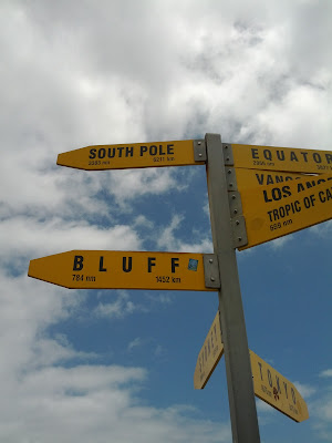
Not long after leaving Kekerengu, I hit the first of two significant milestones for today: 1452km. That may not sound particularly significant, but it's the great-circle distance between Cape Reinga and bluff - so as of today, I've biked the length of NZ, at least in one sense of the term.

This far.
The day was mostly flat, which made the riding easy, but I found myself more worn out than I expected given the last few days' rides, and it didn't take long for some serious muscle ache to set in. I'm at a bit of a loss as to why.

The Kaikoura coast is beautiful, easily one of the nicest landscapes I've ridden through so far. It's probably best described as 'rumpled', as if someone threw down a huge blanket and didn't bother to smooth it out.


The whole day's ride was on State Highway 1, which was often lacking a shoulder, but the road was mostly straight and sight-lines were long, so the occasions I had to worry about traffic were rare. On the other hand, a rumble strip along the shoulder made riding a lot less pleasant than it could have been, as the varying width of the shoulder meant I had to constantly weave in and out of it to stay as far left as I could.

Unfortunately, the weather forecast for the next few days is still just as grim as it was yesterday, with strong southerly (head)winds forecast for the next few days, with rain to top it off. Rain I can handle, but much of the ride to Christchurch will be straight and flat, and the second day is a particularly long one, and riding into a stiff headwind would make the ride singularly unpleasant - not the idea of my trip at all.

With that in mind, I've decided to take a while off for the weather to pass. I booked a train ticket to Christchurch, and hopped on it with my bike, and I'll be staying here with family for a few days until the worst of the southerlies pass. Once they do, I'll get a lift back up to Kaikoura and pick up where I left off.

See you then!

Monday, February 27, 2012

Day 23: Blenheim to Ward(ish)

Distance: 55.9k
Distance so far: 1,432.7
k
Speed: 15.7k/h
Runkeeper log: 1

So, after my minor 300k side-trip to Nelson, today I finally started on the route south in earnest. Today's route was entirely along State Highway 1, taking me from Blenheim to Pedaller's Rest, just south of the tiny town of Ward.

I slept in a bit and got up at 7AM, and was packed and ready at about 20 past, taking a leisurely ride into central Blenheim to seek out a cafe for breakfast. I found one easily, and had a delicious meal of Pancakes and Bacon, and a good coffee, before getting on the road just before 8AM. The sun was peering through a gap in the clouds and casting highlights and shadows across the hills to the south in a most picturesque fashion - a lovely view to start the day with.

The weather today was overcast, but not nearly as cold as it was yesterday. There was more of a southerly wind, though, which continued to plague me throughout the day, providing me with a headwind much of the day. Unfortunately, this seems likely to be the start of a pattern for the next week or so...

The ride was initially fairly flat, but soon turned to hills, a sequence that repeated throughout the day - flat and hilly sections interleaved fairly consistently. This wasn't entirely unpleasant, as all the climbs were fairly steady and manageable, and the downhills added some speed and enjoyment to a day that otherwise contained a lot of slogging along against headwinds - though at times the wind died down enough on the flat for me to ride along at a reasonable speed.

I stopped for a rather disappointing coffee at Seddon. There were two choices for coffee, facing each other across the road, and I think I chose the wrong one, a teahouse that's been (marginally) updated to serve coffee. I attempted to enjoy their rather... novel... rendition of a latte, with limited success.


Just before I arrived in Seddon, I had my first significant mechanical mishap since I had all those problems with the front chainring, somewhere north of Auckland. The pedals momentarily jammed hard, then started working again, but seemingly with a lot more friction than normal. Pedalling still worked, but the chain ground quite perceptibly, and it only got worse if I put more pressure on it. I took the panniers off and examined the rear derailleur with a sinking feeling - since any mishap with it would almost certainly be beyond my ability to fix it on the road - but couldn't see anything wrong with it. I shelved it until after the coffee.

The problem was still there after the coffee, so I took the bags off again for another look. This time, I realised that the chain had come off the idler wheel, which sits just under the seat and provides a clear path for the chain from the front chainrings to the rear cluster. This was something of a relief, actually, since it's easily fixed. A metal bar normally prevents the chain from slipping off the idler, and this must have been what the chain momentarily jammed against. A minute's work with an allen key had the wheel loose enough to replace the chain, and I was back on the road.

The alternating hills and flats continued after Seddon, though with less climbing than before. Not long afterwards, I arrived in Ward, where I stopped for another break and another coffee - significantly better than the last one - before I set out on the last 9k to Pedaller's Rest.

One hill later, I arrived at Pedaller's Rest. This is a bunkhouse with all the usual facilities situated almost exactly halfway between Blenheim and Kaikoura, a stretch that's a bit too long for most people - myself included - to comfortably complete in a day. Once you factor in the hillier terrain on the first half of this ride, it's in pretty much the perfect position to stop for the night. The accommodations are a bit on the basic side, but the beds are soft and the hosts, Jim and Denise, are friendly and welcoming.

I'm the only person staying currently. It's not impossible someone else will turn up later this afternoon, but I suspect I will have the bunkhouse to myself tonight. Tomorrow, I'll ride the rest of the way to Kaikoura. The good news is that the forecast for tomorrow is northerlies - a tailwind! The bad news is that the forecast for the rest of the week is southerlies, and that includes my mammoth 120k day from Cheviot to Christchurch. I'm really, really hoping the forecast is wrong, because it's going to be a real slog if it's not.

Sunday, February 26, 2012

Day 22: Havelock to Blenheim

Distance: 45.5k
Distance so far: 1,376.8
k
Speed: 15.8k/h
Runkeeper logs: 1 2

A pretty relaxed day today, as I cycled from Havelock to Blenheim. The weather this morning was miserable and cold, but not raining, and I had a headwind a lot of the way - so progress was more of a grind than I would have liked. There were no major hills and not much distance to cover, though, so it wasn't too bad.

I got on the road about quarter past seven. As the tour goes on, sunrise is getting noticeably later, and it's getting harder to make an early start - too early and it's still dark, not to mention cold. I guess I should be glad that I have an excuse to sleep in more.

I got to Renwick just after 9AM. Once in Renwick, I was planning to tour a few of the wineries. I started off with Spy Valley wines, which isn't far from downtown Renwick (such as it is). The wines were so good, though, I couldn't resist ordering a few to be shipped back to Sydney, and I curtailed my winery tour to prevent myself from buying even more wine.

The road to Blenheim didn't take long at all. Once there, I found the hostels more booked up than anticipated, but I eventually found one with a spare room. The rest of the day I have to myself for I-don't-know-what - I'm sure I'll find a way to entertain myself.

One concern is that I neglected to put on sunscreen today. Most of my riding was before 10AM, when it becomes a real concern, and it was heavily overcast today, so hopefully I'll be okay. Only time will tell.

Saturday, February 25, 2012

Day 21: Nelson to Havelock

Distance: 75.3k
Distance so far: 1,331.2
k
Speed: ?
Runkeeper log: 1

Today marked the start of my return journey to Blenheim, and the end of my side-trip to Nelson. I'm going back a different - and somewhat more direct - way than the way I arrived, taking State Highway 6, and stopping at Havelock.

There were two major hills for the day, and one small one, all towards the start of the day's riding. The first one, to the Whangamoa Saddle, was fairly epic. The slope wasn't the steepest, but it was still fairly tough, and it just went on, and on, and on, without any respite until the saddle itself. The saddle is at nearly 400 meters above sea level, so I shouldn't be surprised, but it was a very long climb.

For some reason, even though I started Runkeeper recording as I left Nelson, it didn't actually start tracking me until part way up the climb, so today's distance is extrapolate from Google Maps and my route, and runkeeper's average speed for today is, safe to say, entirely inaccurate.

Going down the first hill was a blast, though - mostly straight, with gentle curves and a good slope. The runkeeper page is malfunctioning a bit, so I can't check my top speed, but I'm fairly confident it was about as fast as I've ever gone.

The second hill came not long after the first. After a long and gentle climb up to it - gentle enough I could still make reasonable time on it - the last bit up to the summit was very steep indeed, requiring me to take a break even in the lowest gear. Once over it, though, all the climbing for the day was done, which was a bit of a relief.

Nelson's the sunniest place in NZ, and the rest of the top of the South Island isn't far behind, so the weather was its usual gorgeous self today. It started off cold enough that I wished I had gloves, particularly on the fast downhill sections, but warmed up pretty quickly to a pleasant temperature, never getting hot enough to be a bother.

I stopped briefly at a couple of small towns along the way for coffee and then lunch, and made it into Havelock, the "Mussel Capital of the World", about 1PM.

My room for the night is at the "Rutherford Backpackers'", a YHA hostel, which I booked due to the apparent lack of any BBH hostels in town. It's easily the most run down and dirty of the places I've stayed so far - though it's not any cheaper despite that - and to my intense frustration, there's a shiny, new, and nice looking hostel just across the road, bearing a BBH sign in the window, and a placard proclaiming the exact same rates as here. Why it didn't show up on BBH's site or searches for "havelock hostel", I have no idea. Unfortunately, I've already paid for the night, so I'll have to put up with my current arrangements.

Friday, February 24, 2012

Day off no. 2

Well, at least I have a replacement gear lever. That little snapping feeling as it indexes between gears is remarkably satisfying. And they gave the trike its 1200km tuneup. The continued absence of my mudguards stopped being amusing some time ago, though. At this point my best option seems to be to move on and chase them up over the phone, again. I predict they will finally meet up with me as I arrived, bespeckled with mud, in Bluff, at which point I will no longer need them.

I haven't planned any activities for today, so I'm at a bit of a loose end at the hostel. I'm half tempted to set out for my next destination, Havelock, but it's 75k, and setting out for it at 1PM feels like a bad idea. And my thighs are telling me that maybe a second day off isn't such a bad thing after all.

My plans after getting back to Blenheim are to continue on to Kaikoura, which will either be one epically long but mostly flat day, or two fairly short ones. From there, my initial plan was to head inland to Hanmer Springs, and from there to Christchurch, but I'm pondering skipping Hanmer Springs. It's a bit of a diversion, requires a bit of backtracking, and I've been there I-don't-know-how-many times. It's a nice area, scenically, though. I'll see how I feel about it as I approach Kaikoura.

Thursday, February 23, 2012

Bonus(?) day off

I called into the post office today, and while the parts to attach my mudguards (sent separately) had arrived, the mudguards themselves hadn't. Also, the replacement gear lever for my bike didn't arrive until the afternoon, so the bike shop couldn't install it today.

As a result, it seems I've got no other option than to take an extra day off in Nelson - so I'll be here tomorrow, too, rather than on the road back to Blenheim. I'd honestly rather be back on the move again, but at least my bonus day off is in a nice town.

Today I went on a wine tour with a bunch of other people, the youngest of whom was at least 10 years my senior. I had fun, though, and liked a couple of wines enough to buy some and have them shipped to me.

Day 20: St Arnaud to Nelson

Distance: 94.3k
Distance so far: 1,254.9
k
Speed: 21.3k/h
Runkeeper log: 1


Note: This post refers to the 23rd of February, even though I'm posting it on the 24th. Today is a rest day.


If the hills made yesterday miserable, they made up for it today, with interest. Today's route from St Arnaud to Nelson was largely downhill, with only 3 significant climbs. Most of the downhill was similar in nature to the uphill I experienced yesterday, an incredibly gentle slope that, on the uphill side makes everything a bit more of a drag, but on the downhill side makes riding awesome. Instead of puttering along at 18k/h up a slope so shallow I can't see it, I spent the day cruising along at 25-30k/h, putting in practically no effort as I did so - as my average speed for the day demonstrates.


I started later than usual, since breakfast at the Alpine Lodge starts at 8, and the forecast was for rain to clear in the afternoon, which I wanted to give it plenty of time to do. It was still spitting a bit when I left, but stayed mostly clear as I made the first climb, back to the turnoff to Nelson. Once I was there, the glorious downhill started, and I was able to roar down that section in no time. Pretty soon I had to stop and take off one of my tops, since the day was milder than expected, and the rain absent entirely.


The second major hill hit just as the rain did, so after another stop to change clothes - this time to put on the raincoat - I conquered that climb too. Descending a fairly steep hill afterwards, with rain stinging every exposed bit of skin, was nevertheless still quite fun.


The third climb was much more gradual and sustained, starting with a weird section where the road appears to slope downhill, but actually climbs noticeably. This sort of illusion was somewhat of a theme for the day - often sections that appeared to be uphill were actually flat or even marginally downhill, and sections that appeared to be flat were noticeably downhill. It's weird to gear down for something and then discover you're not actually losing any momentum.


Finally, with all three main climbs out of the way, the rest of the day was glorious downhill, or flat, the whole way. While yesterday's ride seemed like an endless chore, today's was a breeze.


The last 12k or so into Nelson is largely along cycle trails - quite nice, and usually (though not always) well signposted ones. A word of advice for anyone following in my tracks: The "coastal route" is flat as a board, but the "old railway route", somewhat counterintuitively, should be called the "OMG hills!" route.


My mudguards finally arrived in Auckland, so I've directed them to be forwarded to me here in Nelson; I'm also expecting the phone charger I foolishly left in Wellington, and the replacement gear shifter I asked a bike shop to order in. As of today, though, none of those have arrived. Hopefully they arrive tomorrow, because I'm not sure what to do if they haven't.

Tuesday, February 21, 2012

Day 19: Renwick to St Arnaud

Distance: 92.2k
Distance so far: 1,160.6
k
Speed: 16.4k/h
Runkeeper log: 1

As you might guess from the nature of today's log, I opted not to spend the extra day in Renwick and tour the vineyards; there'll be time for that when I come back through this area after visiting Nelson.

A new record for distance for me today as I cycled just over 90 kilometers. In doing so, I gained about 700 meters of elevation, but the gain was extremely gradual - all but 200 meters of that was spread more or less evenly over the entire journey, making for a very gentle gradient indeed, though it was noticeable in the lower gear and lower speed I had to keep to for the day.

The forecast for today was rain in the afternoon, so I set out nice and early, getting on the road at about 7. There's practically nothing on the road, either, so I made myself breakfast before leaving, and took some lunch with me.

Defying the forecast, it started drizzling lightly almost immediately, and it kept drizzling on and off for the first half of the journey, adding a touch of misery to an already fairly dull journey. A little after the halfway mark, the drizzle devolved into outright rain, and I spent the second half of the trip dripping wet.

The road started to climb substantially about 10k from the end - though since my phone had died some time earlier, I didn't know exactly how far from the end I was - and levelled off after about 3k. The last couple of km were blessedly downhill, bringing me into St Arnaud at about 1:30.

I'm staying at the Alpine Lodge, who have a backpackers' in addition to their standard accommodation. The "Backpackers' Chalet" is reasonable, but a bit steep for what you get. At $69 for a private room it's more than the other places I've stayed at, and they nickel and dime you on top of that. Sheets are supplied, but you have to make your own bed, it's $2 for a towel, and they give you a token for the shower, with extra showers costing $2. I did manage to convince the friendly receptionist that since I was paying for a room that sleeps 2, I should get 2 shower tokens, however.

Tomorrow I'm headed for Nelson, an 89 kilometer ride, almost as long as today's. In its favor, though, are two things: It's mostly downhill, in a similar manner to today's gradual climb; and I have the much more bustling and interesting Nelson, and a rest day, to look forward to at the end of it.

On the down side, the forecast is now for rain tomorrow morning as well. I was already planning a later-than-usual start tomorrow so I can get breakfast here; it looks like I may have to procrastinate a little further to avoid the worst of the rain before I set out.

Monday, February 20, 2012

Day 18: Picton to Renwick

Distance: 45.1k
Distance so far: 1,068.4
k
Speed: 19.2k/h
Runkeeper logs: 1 2

Time to get started on the South Island! Today I caught the ferry from Wellington to Picton, then set out from Picton for my destination for the night, Renwick. Renwick is right in the heart of Marlborough's wine country, surrounded on all sides by wineries.

I was first off the ferry at Picton, with myself and the other bike riders positioned right at the front of the hold. Watching the enormous steel doors gradually lower was rather impressive.

The ride out from Picton was a real joy, except from the traffic. There's a short hill to get out of Picton, and then it's more or less flat the whole way, though it felt distinctly like a slight downhill. I cruised along between 25km/h and 30km/h, putting in next to no effort and enjoying the day and the scenery. Traffic was initially pretty heavy, but there was a shoulder most of the way, and the traffic lightened as the ferry emptied out.

Because if you don't you're going to have some mansplaining to do!
I stopped just outside Blenheim at Annie's, where I had a tasty toasted sandwich and a coffee, and picked up a couple of delicious fruit leathers, then continued on through Blenheim, where I made the turnoff to Renwick.

This area is truly saturated with wineries; there's often fields full of grapevines on both sides of the road, and there's plenty of places to go for wine tastings. I stopped off at a couple - Cloudy Bay and Fromm - and the wines were interesting, but none were so amazing I felt compelled to order some to send back home.

The next leg of the trip is west along the inland route to St Arnaud, but I'm considering staying an extra day here and doing a tour of the wineries. Another consideration is that my phone is on its last legs - it refuses to charge from anything except the official AC adapter, and is convinced it's charging even when it's not - and I foolishly left the charger in Wellington. Not having a phone is really going to put a dent in things since I'm using it both to track my progress and as my primary means of Internet access, so taking a day off would allow me to visit Blenheim and pick up a cheap Android alternate phone. I'm incredibly frustrated I have to do this, but getting angry at the phone doesn't seem to make any difference.

Sunday, February 19, 2012

Day 17: Wellington

Distance: 45.5k
Distance so far: 1,023.3
k
Speed: 15.5k/h
Runkeeper log: 1

As you might guess from the title and timing of today's post, I ended up taking the bus from Wanganui to Wellington, following the advice of several people who told me cycling parts of the road to Wellington was taking my life into my hands. Surveying the road from the bus along the way, I'm not inclined to disagree.

I'm a bit disappointed at having to compromise on my 'end to end' goal once again, but on the bright side it's gained me two days that I can spend doing more interesting and exciting things, like exploring the Nelson and Marlborough area.

Today I went out for a ride around Wellington's shoreline - and it has quite a bit of it. The Lonely Planet cycling guide has quite a nice suggestion for a loop, and I largely followed that. The shoreline segment was about 30km long, almost entirely flat, and passing along some lovely coastal scenery along the way. Even so close to town, traffic on most of the roads was very light, making it an all around pleasant ride and a nice way to spend the day in Wellington.

Once I'd completed the shoreline segment, there was a long but gradual climb up Happy Valley Road - nearly 5k long - followed by a much faster, windier descent back into central Wellington. This was mostly pleasant, except when an inattentive motorist cut me off and nearly ran me over in his rush to get onto the motorway onramp. I swore loudly, which attracted a bit of attention, from everyone except the motorist himself.

The ride back to the place where I'm staying was a bit of a slog, ascending Ngaio Gorge Road and then Cockayne Road, both of which are much steeper than Happy Valley Road - in some places so steep that my lowest gear started to feel a bit insufficient.

With that, the North Island part of my tour is done; tomorrow or the next day (I haven't decided for certain yet) I'll get on the Interislander and catch the ferry to Picton, and start my South Island trip. Tonight will be spent planning out exactly where I'm going and where I'll stay along the way.

In a way, as much as I've enjoyed the North Island, it's felt like something I was doing simply in order to be able to get to the South Island. Most people claim that the South Island is a better and more enjoyable place to ride for the most part, and I'm inclined to agree with them. I'm really looking forward to getting started on it.

Also, a major milestone: I've now cycled over 1000 kilometers in my NZ tour! Woohoo!

Friday, February 17, 2012

Day 16: The Flying Fox to Wanganui

Distance: 43.8k
Distance so far: 
977.8k
Speed: 14.9k/h
Runkeeper log: 1

Supposedly, when you've exerted yourself, you don't really feel the impact in your muscles until two days afterwards, and that certainly seemed to be the case today, as my legs made me pay for the epic day from Turangi to Raetihi, making me glad that today was only a short one.

John, my host at The Flying Fox, made me a delicious and generously proportioned continental breakfast, with muesli, fresh Orange Juice, yoghurt, strawberries, fresh bread and more. I had to declare defeat after eating about two thirds of it, lest I be unable to get on the trike. A quick cableway journey had me back on the far bank and ready to go.

Getting up the driveway was the first challenge, since it's gravel and grass and at least a 20% slope. Riding up it was no good, as the rear wheel couldn't get enough traction, so I spent the first 10 minutes or so of my day pushing my bike up the hill.

Once I was on the road, though, the ride was lovely. For some reason I found myself thinking that if hobbits discovered concrete, this is the sort of road they'd build. It's a fairly narrow, unmarked country road, with no markings or signposts, winding its way along the ravine, gently undulating up and down with the countryside. In places, there's no sign of human agency other than the road itself; in other places it's paralleled by farm fences and tall trees shading the road.

The one significant climb of the day came at roughly the halfway mark, and was fairly steep, but an even pace soon had me at the top, despite my legs vociferously reminding me that they were sore from the last couple days' riding. An entire tour bus of people stopped at the top for the view waved at me as I embarked on the downhill side. The downhill ride was a little terrifying, in the vein of yesterday's downhill towards Pipiriki, with steep slopes, sharp unmarked bends, and the constant fear of an oncoming car; I probably spent about half my hard won potential energy heating up the brakepads, but made it to the bottom in one piece.

The remainder of the ride into Wanganui was a bit dull, but very flat, a pleasant change from hills and a good way to rest tired legs. I checked in at the charming Tamara Backpackers. A brief walk into town had me there in time to browse the weekend market, where I met Annette, John's wife, co-owner of the Flying Fox, and mayor of Wanganui. How she finds time to run a market stall on top of all that baffles me.

My hosts here at Tamara have presented me with a bit of a dilemma for tomorrow. The route from here to Wellington, they report, is both boring and dangerous - a reminder of the segment just north of Auckland - and they recommended in the strongest terms that I skip the ride and catch a bus instead, making the observation that doing so is a common choice for touring cyclists. They pointedly mentioned several memorials to unfortunate cyclists along State Highway 1.

Once again I find myself somewhat conflicted as to what to do. Wanganui to Wellington is 200 kilometers, a fair chunk of the north island, and I'd planned to do it over 3 days: Wanganui to Palmerston North, Palmerston North to Waikanae, and Waikanae to Wellington. Skipping it feels distinctly like cheating, even more so than the shorter segment I opted out of north of Auckland. On the other hand, getting killed by a reckless motorist on State Highway 1 is likely to put a rather significant crimp in my plans, and it doesn't seem like I'll be missing out on much in the way of scenery or attractions.

If I must get a bus, it'd be nice to bike at least some of the distance, but the area immediately north of Wellington is reportedly the most dangerous bit, while the area from here to Palmerston North is distinctly boring (though flat - and I love flat).

Whatever I decide, I'll need to make my mind up soon. Wanganui is a nice little town, but I don't really want to spend more than one night in it, with the rest of the country beckoning.

Thursday, February 16, 2012

Day 15: Raetihi to The Flying Fox

Distance: 57.7k
Distance so far: 934.0k
Speed: 13.5k/h

Runkeeper logs: 1 2

Today saw me riding about half the way from Raetihi to Wanganui, stopping for the night at a rather interesting place called The Flying Fox. In sharp contrast to yesterday, the ride was more downhill than up, though there were some surprisingly tough uphill sections.

The Lonely Planet guide claims that 40k of this ride is on a gravel road, which I wasn't really looking forward to. I was very pleased to learn from a local in Raetihi, however, that most of the road has now been sealed, with only a 12k section remaining of the original gravel. Definitely good news to start my day with.

Riding out of Raetihi, the downhill started immediately, allowing me to enjoy the scenery as the road took me in broad sweeps through the countryside. While yesterday was about wide open vistas and views for miles, today's theme seemed to be more close in, with nearby bush-covered hills featuring most of the day. The downhils were welcome, but the uphills were surprisingly tough, requiring me to gear right down and grind up them at a snail's pace - though I suspect this was more to do with my legs being tired from yesterday's ride than it was due to the steepness of the slope. The road was very quiet - throughout the whole day I probably got passed in either direction maybe once every 20 minutes.

Near the halfway point was the tiny village of Pipiriki, where I stopped for a drink. A group of kayakers were very interested in my bike, and after talking to me, took turns riding it around the parking lot before setting out on their own adventure.

Leaving Pipiriki, I turned to follow the Whanganui river. Not much further on, I encountered the start of the gravel road - rutted, potholed, strewn with large stones, and entirely unpleasant to ride on, it spent more time going uphill than down. My progress, swift up until now, ground to a virtual halt even on the flat and downhill sections. Riding on the gravel road required constant attention to dodge the potholes and ruts, trying to find a bit of the road that won't jar myself or my bike to pieces in the process. I did get the occasional marvelous view of the river and the ravine it's gradually channeled out for itself, however.


After that long on a gravel road, riding on a sealed one is an almost religious experience. Making it to the end, I almost wanted to stop there and build a shrine to the Great And Mighty Roadbuilders, Hallowed Be Thy Names.

Has your car gone missing lately? Or maybe just your license plate?
After that, the remaining distance to the Flying Fox went fairly swiftly, impeded only by the hills, and I arrived - later than I expected, but still earlier than the arranged time - at The Flying Fox.

The Flying Fox is a pretty unique sort of place. It's on the other side of the river to the road, and access - as the name implies - is via a cableway suspended over the river.

When the zombie apocalypse arrives, this'd be a pretty good place to be.
The cableway itself is clearly a DIY job, albeit a pretty impressive one - I wish I'd taken photos. The cable that supports the car is securely anchored at each bank, and power is provided by a secondary wire made of - I kid you not - number eight fencing wire. The wire runs around pulleys made from old car wheels at either end, and terminates on opposite sides of the car, which is made primarily from bolted together sections of alumnium L-section.

Power is provided by a motor driving one of the pulleys on the house side. You don't want to be the last person to leave the house, here - if there's nobody on the house end to activate the motor, you have to use a hand crank and winch yourself across the river by arm power. Crossing was an interesting experience, though it didn't feel at all like an unsafe one. The car's fairly slow, giving one plenty of time to admire the view.

My room for the night is the charmingly named "Glory Cart", an old wooden trailer caravan - gypsy style - that's been converted into a stand-alone sleepout. A gas-powered shower and a composting toilet I hope I don't have to use complete the ensemble.

Tomorrow I'll be continuing the rest of the way to Wanganui, a distance of only 46k. The terrain looks macro-scale flat, with only one very steep hill of more than 20 meters or so, but Earth shows it as very up-and-down and claims a total climb of over 900 meters. We'll see how true that is when I tackle it tomorrow morning.

Wednesday, February 15, 2012

Day 14: Turangi to Raetihi

Distance: 88.5k
Distance so far: 876.3k
Speed: 14.8k/h

Runkeeper log: 1

Awesome, awesome day today.

As I mentioned in yesterday's post, today was about 85k long, and involved over 1100 meters of climb - probably more distance and a greater climb than any other day I've done so far.

I got up early as usual, had a rather mediocre breakfast at a truckstop - Turangi is lacking in good cafes - and set out for State Highway 47, the road I'd be following for the day. Pretty much as soon as I left town I hit the first hill, locally referred to as 'the saddle', a steep switchback climb for about 6k. Taking this down took a while, but about halfway up I diverted into a lookout for a quick rest stop, and was greeted with the most amazing view.


The photo really doesn't do it justice, though capturing sunrise vistas is difficult even with a decent camera. The view looked out over lake taupo and the forest and farmland around Turangi, and combined with the light in the east from the rising sun and the mist hovering in places made for an incredible view.

After a short pause to admire the scenery, I continued the climb. It was pretty tough, and I could see why locals had suggested a diversion via a gentler route (but that route added nearly 10k to the day's ride, so I opted for the steeper but shorter option). Eventually making the top, I got to enjoy a short downhill segment, plunging straight into some of that fog. Then, it was back to climbing.

Climbing was more or less the order of the day, but the scenery more than made up for it. Throughout the day I was treated to, at various times, views of farmland, pine forest, native forest, alpine tundra, and more. Every so often I would crest a rise and the view would open out and I'd be able to see for miles.

About a halfway to my lunch stop - the oddly named town of National Park - I stopped for a coffee, discovering that an organised ride was headed my way, going in the opposite direction from Wellington to Auckland. Speaking to one of the organisers, I discovered they started the day in Raetihi, and were going all the way to Taupo - a distance of over 130km!

Before the riders could arrive at the stop and find me being lazy, I got back on the ride, encountering the first of nearly 150 cyclists about 10 minutes later. We waved, gave the thumbs up, and shouted encouragement at each other, a process that repeated itself every 5 minutes or so as another group went past. Pretty much universally, thanks to the terrain, this was while I was crawling up a hill, and they were racing down it. Everyone seemed pretty cheerful and friendly, except perhaps the poor guy crawling along on his own at the back.

Continuing on, the terrain continued to be uphill, the scenery continuted to be amazing, and the weather continued to be cloudy but not raining. I made it to National Park at about midday, just in time to stop for lunch. National Park is about 50k into the ride, and almost all the hills are before it, so I was left with 35k to go, consisting of some uphill sections, some flat, and about 20k of gentle downhill at the end.

Another 15k from National Park and the hills were done with, which is exactly when the rain started. Initially light, it rapidly graduated to 'apocalyptic', just in time for me to hit a major set of roadworks, with dirt laid down on the road. Mud ensued, exacerbated by my lack of mudguards.

Shortly thereafter, the rain let up - and indeed, the road beneath me was dry, tending to indicate it hadn't rained here at all. Then the rain was back, and the road waterlogged and covered in puddles. Then the rain was gone again, the road was dry, and it was hot and sunny. Back to the rain. Back to the sun. Then - I am not joking - I rode through about 30 seconds of hail. Then back to the sun. This continued for most of the rest of the road to Raetihi. I've never encountered a clearer example of microclimates - the differences were stark and startling.

Rolling into Raetihi, I found a room for the night at the Snowy Waters Lodge, a backpackers-style affair that clearly caters mostly to skiiers, and is almost completely deserted as a result.

After tackling everything today could throw at me, cycling over 85 kilometers and climbing over a kilometer in altitude, I've come out the other end with legs sore but not worn out - and I feel like I could do it all over again tomorrow. The impact that two weeks worth of riding has had on my fitness and my endurance is remarkable. If I can take a day like this on, I think I can handle damn near anything.

Tomorrow I'm headed to the Whanganui river, following it for most of the day on a gravel trail - which is likely to be slow, but hopefully not too much of a hassle. The road's part of NZ's new network of cycle trails, and it'll take me most of the way to Wanganui, on the west coast, before I stop for the night at the charming-seeming Flying Fox.

Tuesday, February 14, 2012

Day 13: Taupo to Turangi

Distance: 50.5k
Distance so far: 787.8k
Speed: 18.4k/h

Runkeeper log: 1

Today was a fairly easy ride from the town of Taupo, at the north end of Lake Taupo, to Turangi, located at the south end - a distance of about 50km. There was only one hill worthy of the name, a somewhat infamous one amongst people who cycle around Taupo, but not that bad when it doesn't come at the end of a long day. The rest of the day was pleasantly flat, though with plenty of bends to keep me on my toes.


The weather continues to be ominous and threatening, but it didn't start raining until well after I arrived at Turangi. The forecast does not bode well for my next few days ride, however.

Tomorrow I'm continuing on through the Whanganui ranges to the tiny town of Raetihi. It's going to be a hard day - 85k and over 1000 meters of climb. Beyond that, I have even more climbing to look forward to the day after, as well as 40km on a gravel road. In return, though, I can expect some pretty awesome views. I'm hoping against hope that the weather is better than the forecast - rain on top of it would make it pretty unbearable.

Monday, February 13, 2012

Day off in Taupo

I've decided to take today off. Originally, because the forecast was awful, though the weather's looking quite nice now, but it also helps that I'm in Taupo, and there's a lot to do here - something that won't be true for many of my next few stops.

Rafting the Kaituna video

Here's the highlights of the rafting trip, including going down the big waterfall, and getting flipped over.


Sunday, February 12, 2012

Day 12: Rotorua to Taupo


Distance: 82.2k
Distance so far: 737.3k
Speed: 18k/h

Runkeeper logs: 1 2

Today's leg, from Rotorua to Taupo, takes me further into the heart of the North Island. Rotorua is pretty much geothermal activity central, but that extends further south, too - there's a beach on Lake Taupo that's so active you can catch a fish, then bury it in the sand to cook it.

I got up early as usual, and had a delicious breakfast at the Fat Dog Cafe, which seems to be something of a Rotorua icon. They do excellent coffee, but the bacon was rather disappointing. It was drizzly in the morning, but I set out anyway, initially in the same gear - merino top and sports shorts - that I usually wear, with the addition of a 'softshell' jacket.

The jacket quickly proved too warm for the conditions, but without it the breeze was too chilly on wet skin, so I swapped to my raincoat - the first time I've needed it, and more for the wind than the rain. That worked for a while, but despite its being Gore-Tex, it still ended up nearly as wet on the inside - from sweat - than on the outside. At my rest stop, I packed it away, and switched to wearing thermal underwear - long sleeved top and pants - under my usual cycling gear, and just tolerating getting wet. This seemed to work pretty well, and even when it started raining for real and I got thoroughly wet, I stayed nice and warm. I realize I sound like an Icebreaker salesperson, but this stuff is simply amazing.

The miserable wet weather continued for pretty much my whole ride, alternating between drizzle, actual rain, and merely threatening. When it wasn't actively raining, the ride was fine, but the drizzle gets in my eyes, making riding difficult, and the front wheels pick up any water on the road, generating rain showers of their own if there's the slightest bit of crosswind. Fenders would be great here, but they still haven't arrived.

Trucks also present interesting challenges in the wet. Ones going the same way are mostly fine, but ones going the other way generate a constant wavefront of atomized water picked up off the road by their wheels. When there's only a little, it's kind of cool watching it roll towards you, but when there's a lot it's like someone coming up and blasting you in the face with a spray bottle every time one goes past.

As far as the scenery goes, today wasn't much to write home about - mostly farmland, some pine forests, and a little native bush, with the occasional geothermal source to break up the monotony. The start was a bit hilly climbing out of Rotorua, but it was even easier than yesterday's climb. Then the route was mostly flat until about 15k from Taupo, where there's another, even easier again, set of hills. On a nice day, it would've made for a fairly pleasant ride.

I'm theoretically headed to Turangi tomorrow, which involves a lovely ride along the shores of lake Taupo, and only one major (and fairly infamous) hill. Depending on the weather, though, I may put it off a day, or ride in the afternoon, when it's supposed to be less rainy.

I'm now roughly 400 meters above sea level, and I'm looking forward to reaping the rewards in the form of downhills when I approach the west coast in a few days.

Saturday, February 11, 2012

Rest day in Rotorua

Today was officially a rest day in Rotorua - which doesn't mean I have to actually, you know, rest, just that I don't do any cycling. So I went whitewater rafting.


I had a real blast. The time on the water was less than an hour, but we went through two waterfalls - one, at about 7 meters high, is the highest commercially rafted waterfall in the world - and a bunch of rapids. Going over the larger waterfall, the raft flipped - we were warned it was a possibility - and so we spent the next few minutes getting everyone back aboard.

More photos here. As you can see, I was wearing my GoPro camera on my helmet, and I've edited together a few of the first-person-highlights, but internet access here at the hostel is pretty pricey, so I won't be able to upload it for a day or two.

I also went on the luge, which, to be honest, was a bit of an anticlimax. I kept thinking that the tracks would be a whole lot more fun on my trike.

Friday, February 10, 2012

Day 11: Lake Karapiro to Rotorua

Distance: 65.2k
Distance so far: 655.1k
Speed: 14.3k/h

Runkeeper log: 1
Have you ever picked up a suitcase, believing it to be full, only to find it empty? That's more or less what today felt like.

I set out later than usual, after a large breakfast kindly provided by my hosts at the Lake Karapiro Lodge, getting on the road around 8AM. The road was already pretty busy, but the shoulder continued to be ample much of the way, and things quietened down a bit - though not as much as I would have liked - after I split off from SH1.

The weather was largely overcast, with ominous looking clouds, though the forecast says no rain until later in the week.

Since I knew I had a lot of climbing lined up, my goal for today was energy conservation: take it really easy on the flats, take rest breaks whenever the opportunity presented itself, and generally take it easy, saving my energy - and my knees - for the climb. I trundled into Tirau, about 15k from my start point and took a short break to stretch my legs and have coffee.

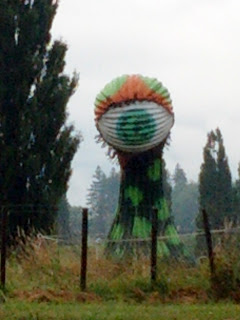
An interesting sculpture I spotted on the way to Tirau.
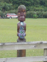
From there I continued on, taking another short break just after Tapapa, at a cafe in a stand of native bush that I have fond memories of from my childhood, though its name escapes me (and Google Maps fails me). At Tapapa, there were some interestingly decorated - and seemingly fairly recent - Maori totems on display at the Marae:


After that, there were no more rest breaks for the rest of the climb, so I set at it, taking it nice and slow, though pleasingly none of the slopes were so steep I had to resort to my lowest gear.

This is where the easier-than-expected bit comes in. I was still in the grinding-along mindset, figuring I had at least 5k, maybe 10k to go, when things started evening out. Then there was some up and down, with a bit more down than up. Then it was all down, and I was pretty clearly past the top. With impeccable timing, the sun even came out briefly.

The rest of the way to Rotorua was a joy. First, a long gentle downhill stretch with no sharp corners let me roar down the hill at probably about 50k/h for a good 10 or 15 minutes - all of which left me in a "let's go again!" type mood. After that, nice easy straight stretches the rest of the way into town - and having saved my energy for a hill that never materialized, I made short work of those.

I've taken two nights at a Backpackers' here in Rotorua, figuring I'd need the rest day, but I'm half wondering if I really do. My knees are protesting somewhat, but I still feel pretty energetic, and there's a temptation to head on to Taupo, since tomorrow is supposed to be the last non-rainy day I'll get for a while. I'll probably take the rest day, though - there's plenty of interesting ways to spend a spare day in Rotorua, and I'd best tackle the hills on the way to Taupo with fresh legs.

Thursday, February 9, 2012

Day 10: Hamilton to Lake Karapiro

Distance: 52.8k
Distance so far: 589.9k
Speed: 17.1k/h

Runkeeper logs: 1 2

Today's ride took me from Hamilton to Lake Karapiro, a little under halfway to Rotorua. Hamilton to Rotorua is a little over 100km, the second half of which is mostly uphill, and I wanted to break that up a bit. Even with the rest, I'm anticipating a fairly tough day tomorrow as I climb the caldera into Rotorua.

I took Lonely Planet's advice and went via the charmingly named Mystery Creek Road, out by the airport, which took me along a route on the other side of the river to State Highway 1 into Cambridge. Following Google Maps' directions to get to the airport took me via a nice path along a lake, too - very pretty early in the morning with mist still clinging to the surface.

The route was pretty flat, with only a couple of hills that required me to gear down - though one of those was pretty intimidatingly steep, coming after a similarly steep downhill and a (thankfully dry) ford. I stopped just outside Cambridge for an excellent breakfast at a rural cafe that also serves as an art gallery for local artists. I got there about 8:30, and although they weren't officially open until 9, they were kind enough to serve me breakfast all the same.

Continuing on through Cambridge, I switched over to the other side of the river and rode the rest of the way, about 20km, on State Highway 1. SH1 was busy, as always, but had a wide shoulder most of the way, as it did yesterday. The ride was fairly short and not particularly unpleasant.

Tonight I'm staying at the Lake Karapiro Lodge, which is somewhat more upscale (and expensive) than the places I've been staying so far. It's very nice, though, with a stunning view of the lake from the top of its hill, which was the only one so far that was so steep I had to get out and push. Accommodation options around here are a bit limited, but one of the reasons I chose to stay here was that the hosts very kindly offered to drop me off at Hobbiton so I could do the tour, and picked me up again afterwards.

Hobbiton is the scene of the movie set used for Lord of the Rings and The Hobbit. After LOTR, they tore down most of it, but they rebuilt it for The Hobbit movies, this time using permanent materials, and it's been left up as an attraction. The tour was interesting, though a touch expensive, and since the insides of the hobbit holes are all sets built offsite, it's a strictly outdoors-only tour. Nevertheless, it's a pretty convincing location, and if you were surrounded by hobbits rather than other tourists with cameras, you could just about believe you'd been transported to Middle Earth.

I took lots of photos, but they made us sign a confidentiality agreement beforehand agreeing we wouldn't post them publicly anywhere, at least until after the movies come out. So here's just about the only thing I _can_ show you.


Tomorrow, Rotorua. If you don't hear from me again, it's because I died from exhaustion trying to climb the caldera. Tell my family I love them.

Wednesday, February 8, 2012

Day 9: Pukekawa to Hamilton

Distance: 70.3k
Distance so far: 537.1k
Speed: 18.7k/h

Runkeeper logs: 1 2

Today's ride was one of the days I had in mind when I set out on this tour. Clear blue skies, moderate temperature, and not a hill in sight (except the one I rode down at the start). Most of the day had me following the Waikato river along country roads, on the opposite side to State Highway 1, though a dismaying few kilometers were unexpectedly on a gravel road, which made things briefly unpleasant. Other than that, the lack of wind and the flat terrain made today's ride a pleasure.

I set off early again at about 7:15, and stopped around 9:15 at Huntly for a very good breakfast and a coffee. Shortly thereafter, my cellphone died - I've been having problems with my solar charging solution - so I had to ride the rest of the way without a cycle computer. That's also why it would be a good idea to distrust the reported speeds in Runkeeper for the second half of my journey.

Continuing south on the quiet side of the river, I made it to Ngaruwahia, where State Highway 1 crosses over to the same side. Rather than swap over to the other side myself, I opted to take my chances with State Highway 1.

Fortunately, this stretch of SH1 has a wide, evenly paved shoulder pretty much the whole way, so although it's busy and noisy, and the speed and frequency of cars and trucks are a bit unnerving, it's fairly safe. The only downside was that the main road was paved with smooth new blacktop, while the shoulder was still chip-and-seal - so the next few kilometers felt like being taunted with the smooth ride that was just out of my reach. Oh well.

Heading into Hamilton was a bit unnerving, as I had to navigate through heavy traffic, but I soon got on to the quieter side-roads, and found my way to my stop for the night fairly easily.

Tomorrow I'm headed towards Rotorua - I'm looking for somewhere to stop halfway along - and possibly a side-trip to see Hobbiton, which is pretty close to the halfway point.

Tuesday, February 7, 2012

Day 8: Auckland to Pukekawa

Distance: 70k
Distance so far: 467.1k
Speed: 16.1k/h

Runkeeper logs: 1 2

Going from Hamilton to Auckland, I have a number of possible routes, with varying levels of directness, danger, hills, and pleasant scenery. After some consideration, I've decided to break the trip up into 2 days, rather than one marathon day, and take a route away from the main highways - which means slightly more in the way of hills, but an altogether more pleasant ride. It also lets me visit this rather nice sounding hostel that's right along my proposed route.

Another early morning today, as I set off from Auckland, getting started a little before 7AM, hoping to avoid the worst of the suburban traffic. This was in vain, unfortunately, with the roads already pretty busy by the time I got on them. The first 25k or so, as I wended my way first through Auckland's eastern suburbs, then along Great South Road, were a bit hairy, but motorists were generally careful around me. Nevertheless, I was glad to get out of the suburbs and onto quieter, more rural roads.

I bet you didn't know potatoes grew in sacks.
The weather today, was wonderful - blue skies and fluffy white clouds, warm but not scorching, and no wind to speak of - absolutely perfect for riding. I made good time until about kilometer 30, where I encountered the first of the two hills in today's ride. Climbing slowed me down, naturally, but the hill wasn't particularly tall or steep, and it's far too nice a day to be put in a bad mood by a hill or two.

The road goes ever on and on...


At some point along the route, I passed out of Auckland and into the Waikato:


Shortly after the hill, I stopped in Tuakau for a coffee break and a bit of late breakfast, then set out for the final 18k or so to my accommodations for the night.

The place I'm staying tonight is called Shekinah Farm, a remote little hostel conveniently placed about halfway between Auckland and Hamilton. It's quite lovely, and I'm staying in a little cabin apart from the main house:


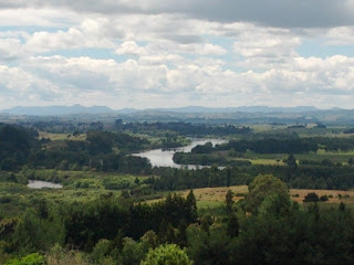
The view from my cabin is... well, see for yourself:


Tomorrow, I continue on to Hamilton. It'll be about the same distance as today, but almost entirely flat. I'm looking forward to it.